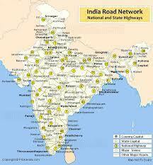
Road Map of India
This product is not available in the selected currency.
In Stock
Backordered
Out of Stock
Description
- Comprehensive Coverage: Provides an overview of India's road network, including national highways, state highways, and rural roads.
- Road Classification: Differentiates between primary arterial routes, secondary roads, and local streets.
- Major Intersections: Identifies key junctions and interchanges for route planning and navigation.
- Landmarks and Points of Interest: Highlights tourist attractions, service facilities, and transportation hubs.
- Geographical Features: Depicts terrain, rivers, and coastal regions, offering context to the road network.
- Administrative Boundaries: Delineates state and district boundaries for governance and jurisdictional clarity.
- Distance and Travel Time: Provides information on distances and estimated travel times between locations.
- Intermodal Connectivity: Illustrates connections with airports, railway stations, bus terminals, and seaports.
- Logistics Planning: Aids motorists, truck drivers, and travelers in route planning and scheduling.
- Information Resource: Essential tool for navigation, commerce, tourism, urban planning, and research.
Opps
Sorry, it looks like some products are not available in selected quantity.
.png)

